Mesalia
Mesalia is a genus of sea snails, marine gastropod mollusks in the family Turritellidae.

H. Zell · CC BY-SA 3.0 · via Wikipedia/Commons. May be a photograph of a specimen, or an artist’s reconstruction — an interpretation of a skeleton, since colour and soft tissue are almost never preserved.
On record
Recorded, not inferred- Sits inside
- PareorinaePBDB
- Diet
- suspension feederPBDB
- Life habit
- semi-infaunalPBDB
- Motility
- facultatively mobilePBDB
- Vision
- limitedPBDB, for Gastropoda
Time the record covers
At least 199 million years on record.
The record covers at least 199.5 Mya to 11.7 ka. No occurrence read is dated outside 201.4 Mya to 0 Mya.
385 occurrences of Mesalia on record, most of them in the Paleocene. The Paleobiology Database records this as a living group. Bar height is expected occurrences, not a count: each fossil is spread across the span it is dated to, so a tall narrow bar means tight dating and a low wide one means loose.
When
385 occurrences- Early Jurassicunder 1%
- Early Cretaceous3%
- Late Cretaceous4%
- Paleocene52%
- Eocene36%
- Oligoceneunder 1%
- Miocene3%
- Pleistocene1%
- Holoceneunder 1%
These are dates about fossils, not the animal: the record can only begin after it arose and end before it died out, so either end may reach further. Shares are expected occurrences: a fossil dated to a span is counted partly in each period it straddles. More on what this infers.
Found in
71 formations
- Clayton Formation · Midway Group34
- Santa Susana Formation33
- Cook Mountain Formation · Claiborne Group28
- Porters Creek Formation · Midway Group27
- Lisbon Formation · Claiborne Group26
- Gosport Sand Formation · Claiborne Group20
Loading coastlines…
The named rock units Mesalia has been recovered from, largest first. Drawn where the rock is now, not where it formed. 47 further formations hold fewer occurrences each and are not listed. 35 occurrences have no formation on record, which is common for older literature.
Mesalia and its relatives
PaleoceneWhere Mesalia and its relatives were recorded in the Paleocene.
Found in the same rock
2,737 taxa- Turritella106 sites
- Pseudoliva vetusta54 sites
- Pitar51 sites
- Venericardia48 sites
- Ficus45 sites
- Athleta petrosa44 sites
- Ancilla staminea42 sites
- Calyptraea (Trochita) aperta42 sites
- Natica42 sites
- Dentalium41 sites
- Cadulus39 sites
- Polinices39 sites
- Retusa galba38 sites
- Buccitriton texanum37 sites
- Calyptraphorus velatus36 sites
- Turricula36 sites
- Barbatia (Plagiarca) rhomboidella35 sites
- Levifusus mortoniopsis34 sites
- Corbula (Caryocorbula) alabamiensis33 sites
- Venericardia (Rotundicardia) rotunda33 sites
- Cucullaea32 sites
- Tellina32 sites
- Bullata semen31 sites
- Sinum31 sites
The Paleobiology Database records 265 sites for Mesalia, and this reads 240 of them. Of that, one read hit the database's own return limit, so every count below is a floor rather than a total. The number is how many of those sites it was catalogued from too. The 24 sharing the most are listed.
This is not a list of everything alive at the time. It is only what has come out of the same ground as this animal and been written down.
Entered from
76 references- Catalogue of the Paleocene and Eocene mollusca of the southern and eastern United States. Part 1. Pelecypoda, Amphineura, Pteropoda, Scaphopoda and Cephalopoda55
- Stratigraphic Distribution of Paleocene and Eocene Fossils in the Eastern Gulf Coast Region45
- Resilience of marine invertebrate communities during the early Cenozoic hyperthermals38
- Impact of lithification on the diversity, size distribution, and recovery dynamics of marine invertebrate assemblages21
- A contribution to the paleontology of the Martinez Eocene of California20
- Faunal stability and environmental change in the middle Eocene Gulf Coastal Plain (PhD Thesis, Harvard University)14
- Ecological control of evolutionary rates in Paleocene - Eocene marine molluscs13
- Paleocene pareorine turritellid gastropods from the Pacific slope of North America11
- Effects of sampling on paleoecologic and taphonomic analyses in high-diversity fossil accumulations: an example from the Eocene Gosport Sand, Alabama11
- A monograph on the Egyptian Paleocene and Eocene gastropods9
- Mollusca of the Tertiary formations of Northeastern Mexico9
- Stratigraphy and Paleontology of the Ewekoro Formation (Paleocene) of Southwestern Nigeria8
Each of the 385 occurrences read was entered from one of these publications, ordered by how many each accounts for. This is not a search for papers mentioning the name. 64 further references are not listed. Entries link to doi.org where the Paleobiology Database holds an identifier, and to its own record where it does not. Relayed as the Paleobiology Database holds them, not checked against what they resolve to.
Media and terms
Media content2

Picture of Mesalia
- Source
- Wikipedia/Commons
- Credit
- H. Zell
- Licence
- CC BY-SA 3.0
- Commercial use
- the licence allows it
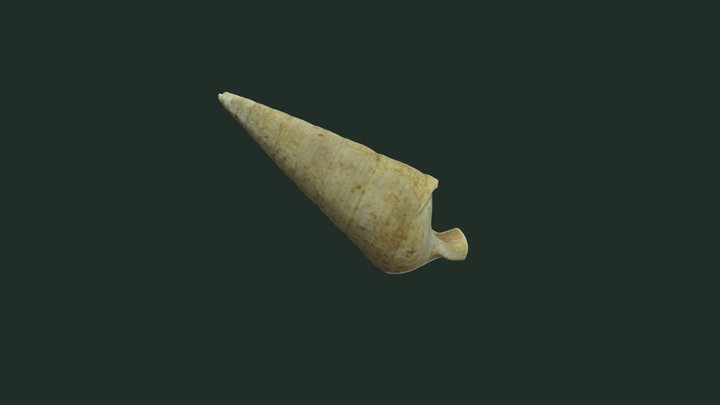
3D model
- Source
- Sketchfab
- Credit
- Shellie Luallin
- Licence
- CC Attribution
- Commercial use
- cannot be read from the licence given — check the record
The description on this site
- Source
- Wikipedia, “Mesalia”
- Licence
- CC BY-SA 4.0
This is what the site found, which is not the same as what exists.
Keep going
What may have been alongside itPareorinae through timeFormations of the PaleoceneThe world it lived on
Occurrence data from the Paleobiology Database, CC BY 4.0. (Gray 1847)