Leptaena
Leptaena is an extinct genus of mid-sized brachiopod that existed from the Dariwilian epoch to the Emsian epoch, though some specimens have been found in strata as late in age as the Tournasian epoch. Like some other Strophomenids, Lepteana were epifaunal, meaning they lived on top of the seafloor, not buried within it, and were suspension feeders.

Dwergenpaartje · CC BY-SA 3.0 · via Wikipedia/Commons. May be a photograph of a specimen, or an artist’s reconstruction — an interpretation of a skeleton, since colour and soft tissue are almost never preserved.
On record
Recorded, not inferred- Sits inside
- LeptaeninaePBDB
- Diet
- suspension feederPBDB
- Life habit
- epifaunalPBDB
- Motility
- stationaryPBDB
- Vision
- blindPBDB, for Strophomenata
- Environment
- marinePBDB, for Lophophorata
Time the record covers
At least 118 million years on record.
The record covers at least 458.2 Mya to 339.9 Mya. No occurrence read is dated outside 469.4 Mya to 335.9 Mya.
1,581 occurrences of Leptaena on record, most of them in the Silurian. Bar height is expected occurrences, not a count: each fossil is spread across the span it is dated to, so a tall narrow bar means tight dating and a low wide one means loose.
When
1,581 occurrences- Ordovician37%
- Silurian49%
- Devonian13%
- Carboniferousunder 1%
These are dates about fossils, not the animal: the record can only begin after it arose and end before it died out, so either end may reach further. Shares are expected occurrences: a fossil dated to a span is counted partly in each period it straddles. More on what this infers.
Found in
440 formations
- Ellis Bay Formation · Jolliet Group38
- Onondaga Formation37
- Kahula Formation37
- Waynesville Formation · Richmondian Group35
- Jupiter Formation28
- Henryhouse Formation22
Loading coastlines…
The named rock units Leptaena has been recovered from, largest first. Drawn where the rock is now, not where it formed. 416 further formations hold fewer occurrences each and are not listed. 210 occurrences have no formation on record, which is common for older literature.
Leptaena and its relatives
SilurianWhere Leptaena and its relatives were recorded in the Silurian.
Found in the same rock
1,806 taxa- Crinoidea53 sites
- Leangella scissa48 sites
- Atrypa47 sites
- Eoplectodonta (Eoplectodonta) duplicata47 sites
- Dalmanella40 sites
- Paracraniops38 sites
- Bryozoa37 sites
- Isorthis35 sites
- Skenidioides33 sites
- Trepostomata33 sites
- Strophonella32 sites
- Schuchertella31 sites
- Skenidioides woodlandiensis31 sites
- Sowerbyella31 sites
- Howellella30 sites
- Lingula30 sites
- Resserella30 sites
- Tentaculites30 sites
- Dolerorthis29 sites
- Eoplectodonta29 sites
- Modiolopsis29 sites
- Rugosa28 sites
- Calymene27 sites
- Cornulites27 sites
The Paleobiology Database records 1,464 sites for Leptaena, and this reads 240 of them. The number is how many of those sites it was catalogued from too. The 24 sharing the most are listed.
This is not a list of everything alive at the time. It is only what has come out of the same ground as this animal and been written down.
Entered from
333 references- Ordovician strophomenoid brachiopods of northern Estonia76
- Late Ordovician and Early Silurian strophomenid brachiopods of Anticosti Island, Quebec, Canada76
- The Clinton of Western and Central New York66
- Early Llandovery brachiopods of Wales50
- Silurian brachiopods Dictyonellida, Strophomenida, Productida, Orthotetida, Protorthida and Orthida from Estonia48
- Gradient ecology of a biotic invasion: biofacies of the type Cincinnatian Series (Upper Ordovician), Cincinnati, Ohio region, USA44
- Caradocian-Gedinnian echinoderm associations of Central and Eastern North America36
- Great Basin Lower Devonian Brachiopoda28
- Silurian Leptaeninae (Brachiopoda) from Gotland, Sweden27
- GIS-based biogeography of Cincinnatian (Upper Ordovician) brachiopods with special reference to Hebertella25
- Silurian Reefs of Gotland21
- Silurian and Lochkovian communities in the Prague basin (Barrandian area, Czech Republic)20
Each of the 1,581 occurrences read was entered from one of these publications, ordered by how many each accounts for. This is not a search for papers mentioning the name. 321 further references are not listed. Entries link to doi.org where the Paleobiology Database holds an identifier, and to its own record where it does not. Relayed as the Paleobiology Database holds them, not checked against what they resolve to.
Media and terms
Media content2

Picture of Leptaena
- Source
- Wikipedia/Commons
- Credit
- Dwergenpaartje
- Licence
- CC BY-SA 3.0
- Commercial use
- the licence allows it
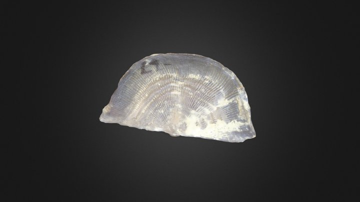
3D model
- Source
- Sketchfab
- Licence
- CC0 Public Domain
- Commercial use
- the licence allows it
Smithsonian Open Access and MorphoSource were not reached for this taxon, so this list is what the others held rather than everything there is.
The description on this site
- Source
- Wikipedia, “Leptaena”
- Licence
- CC BY-SA 4.0
This is what the site found, which is not the same as what exists.
Keep going
What may have been alongside itLeptaeninae through timeFormations of the SilurianThe world it lived on
Occurrence data from the Paleobiology Database, CC BY 4.0. Dalman 1828