Neochonetes
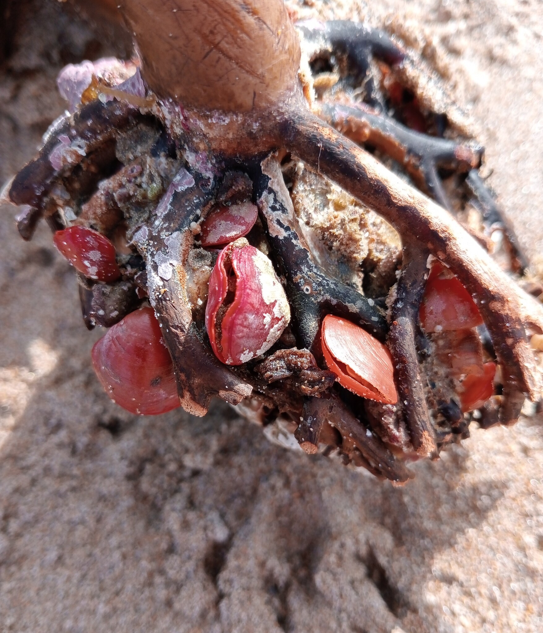
Not Neochonetes. This is Calloria inconspicua (Sowerby, 1846), a relative.
Clinton Duffy · CC BY-NC 4.0 · via GBIF. May be a photograph of a specimen, or an artist’s reconstruction — an interpretation of a skeleton, since colour and soft tissue are almost never preserved.
On record
Recorded, not inferred- Sits inside
- RugariiniPBDB
- Diet
- suspension feederPBDB, for Chonetidina
- Life habit
- low-level epifaunalPBDB, for Chonetidina
- Motility
- stationaryPBDB, for Chonetidina
- Vision
- blindPBDB, for Strophomenata
- Environment
- marinePBDB, for Lophophorata
Time the record covers
At least 83 million years on record.
The record covers at least 335.4 Mya to 251.902 Mya. No occurrence read is dated outside 358.86 Mya to 251.1 Mya.
1,053 occurrences of Neochonetes on record, most of them in the Permian. Bar height is expected occurrences, not a count: each fossil is spread across the span it is dated to, so a tall narrow bar means tight dating and a low wide one means loose.
When
1,053 occurrences- Carboniferous18%
- Permian81%
- Early Triassicunder 1%
These are dates about fossils, not the animal: the record can only begin after it arose and end before it died out, so either end may reach further. Shares are expected occurrences: a fossil dated to a span is counted partly in each period it straddles. More on what this infers.
Found in
185 formations
- Longtan Formation109
- Changxing Formation94
- Graham Formation · Cisco Group39
- Foraker Limestone Formation · Council Grove Group39
- Wood Siding Formation · Wabaunsee Group38
- Callytharra Formation31
Loading coastlines…
The named rock units Neochonetes has been recovered from, largest first. Drawn where the rock is now, not where it formed. 161 further formations hold fewer occurrences each and are not listed. 86 occurrences have no formation on record, which is common for older literature.
Neochonetes and its relatives
PermianWhere Neochonetes and its relatives were recorded in the Permian.
Found in the same rock
200 taxa- Crinoidea101 sites
- Reticulatia huecoensis100 sites
- Neospirifer dunbari99 sites
- Composita subtilita91 sites
- Hystriculina wabashensis84 sites
- Derbyia82 sites
- Fusulinidae78 sites
- Hustedia mormoni71 sites
- Echinoidea63 sites
- Trepostomata62 sites
- Crurithyris expansa61 sites
- Punctospirifer kentuckensis51 sites
- Derbyia crassa46 sites
- Parajuresania nebrascensis45 sites
- Bryozoa41 sites
- Linoproductus41 sites
- Lissochonetes geronticus39 sites
- Crurithyris36 sites
- Meekella36 sites
- Linipalus magnispinus34 sites
- Neospirifer31 sites
- Linoproductus prattenianus27 sites
- Composita26 sites
- Fenestrata26 sites
The Paleobiology Database records 886 sites for Neochonetes, and this reads 240 of them. The number is how many of those sites it was catalogued from too. The 24 sharing the most are listed.
This is not a list of everything alive at the time. It is only what has come out of the same ground as this animal and been written down.
Entered from
191 references- Stratigraphy and Paleontology of the Uppermost Pennsylvanian and Lowermost Permian Rocks in Kansas148
- T.D. Olszewski''s Ph.D. - Penn State University52
- Permian Brachiopods of West Texas, VI43
- A new Changhsingian (Late Permian) brachiopod fauna from the Zhongzhai section (South China) Part 3: Productida41
- Stratigraphic and Paleontologic Studies of the Pennsylvanian and Permian Rocks in North-Central Texas37
- A new Changhsingian (Late Permian) Rugosochonetidae (Brachiopoda) fauna from the Zhongzhai section, southwestern Guizhou Province, South China31
- Studies on Western Australian Permian brachiopods 2. The Family Rugosochonetidae Muir-Wood 196229
- Changhsingian brachiopod assemblage sequence in Zhongliang Hill, Chongqing26
- Foraminifera and their habitats within a cool-water carbonate succession following glaciation, Early Permian (Sakmarian), Western Australia23
- Paleoecology of brachiopod communities during the late Paleozoic ice age in Bolivia (Copacabana Formation, Pennsylvanian-Early Permian)20
- Brakhiopody nizhney Permi i iz znachenie dlya stratigrahii vostochno-Ukrainskogo Neftegazonosnogo basseyna19
- Lopingian (Late Permian) brachiopods around the Wuchiapingian-Changhsingian boundary at the Meishan sections C and D, Changxing, south China18
Each of the 1,053 occurrences read was entered from one of these publications, ordered by how many each accounts for. This is not a search for papers mentioning the name. 179 further references are not listed. Entries link to doi.org where the Paleobiology Database holds an identifier, and to its own record where it does not. Relayed as the Paleobiology Database holds them, not checked against what they resolve to.
Media and terms
Media content1
Picture of Calloria inconspicua (Sowerby, 1846)
- Source
- GBIF
- Credit
- Clinton Duffy
- Licence
- CC BY-NC 4.0
- Commercial use
- the licence does not allow it
No 3D scan was found. Smithsonian Open Access, MorphoSource and Sketchfab were all searched.
This is what the site found, which is not the same as what exists.
Keep going
What may have been alongside itRugariini through timeFormations of the PermianThe world it lived on
Occurrence data from the Paleobiology Database, CC BY 4.0. Muir-Wood 1962