Balanidae
The Balanidae is a family of barnacles of the order Balanomorpha. As a result of research published in 2021 by Chan et al., the members of the family Archaeobalanidae were merged with this family.

DOI (Department of the Interior) · Public Domain · via Wikipedia/Commons. May be a photograph of a specimen, or an artist’s reconstruction — an interpretation of a skeleton, since colour and soft tissue are almost never preserved.
On record
Recorded, not inferred- Sits inside
- BalanoideaPBDB
- Diet
- suspension feederPBDB
- Life habit
- epifaunal, gregariousPBDB
- Motility
- stationary, attached, epibiontPBDB
- Vision
- limitedPBDB, for Cirripedia
Time the record covers
At least 184 million years on record.
The record covers at least 184.2 Mya to 11.7 ka. No occurrence read is dated outside 192.9 Mya to 0 Mya.
859 occurrences of Balanidae on record, most of them in the Miocene. The Paleobiology Database records this as a living group. Bar height is expected occurrences, not a count: each fossil is spread across the span it is dated to, so a tall narrow bar means tight dating and a low wide one means loose.
When
859 occurrences- Early Jurassicunder 1%
- Early Cretaceousunder 1%
- Late Cretaceousunder 1%
- Paleoceneunder 1%
- Eocene4%
- Oligocene5%
- Miocene39%
- Pliocene17%
- Pleistocene32%
- Holocene2%
These are dates about fossils, not the animal: the record can only begin after it arose and end before it died out, so either end may reach further. Shares are expected occurrences: a fossil dated to a span is counted partly in each period it straddles. More on what this infers.
Found in
159 formations
- Vaqueros Formation68
- Choptank Formation · Chesapeake Group36
- St Marys Formation · Chesapeake Group24
- Yorktown Formation · Chesapeake Group23
- Careaga Sandstone Formation21
- Pancho Rico Formation18
Loading coastlines…
The named rock units Balanidae has been recovered from, largest first. Drawn where the rock is now, not where it formed. 135 further formations hold fewer occurrences each and are not listed. 247 occurrences have no formation on record, which is common for older literature.
Balanidae and its relatives
MioceneWhere Balanidae and its relatives were recorded in the Miocene.
Found in the same rock
2,949 taxa- Balanus141 sites
- Ostrea40 sites
- Concavus concavus31 sites
- Turritella27 sites
- Dosinia acetabulum26 sites
- Hiatella arctica25 sites
- Chlamys24 sites
- Conradostrea sculpturata22 sites
- Euspira heros22 sites
- Bicorbula idonea21 sites
- Chesacardium laqueatum21 sites
- Parvilucina crenulata21 sites
- Chesapecten (Chesapecten) nefrens20 sites
- Crepidula plana20 sites
- Crepidula fornicata19 sites
- Mercenaria19 sites
- Calliostoma18 sites
- Anadara17 sites
- Astarte thisphila17 sites
- Busycon17 sites
- Corbula inaequalis17 sites
- Nucula (Nucula) proxima17 sites
- Tellina17 sites
- Dallarca staminea16 sites
The Paleobiology Database records 570 sites for Balanidae, and this reads 240 of them. The number is how many of those sites it was catalogued from too. The 24 sharing the most are listed.
This is not a list of everything alive at the time. It is only what has come out of the same ground as this animal and been written down.
Entered from
219 references- The Vaqueros Formation, Lower Miocene of California. I. Paleontology64
- Systematics and biostratigraphy of Miocene Cirripedia of the Chesapeake Group; Maryland, North Carolina, and Virginia46
- Revision of the balanid barnacle genus Concavus Newman, 1982, with the description of a new subfamily, two new genera, and eight new species42
- Eocene Balanidae of Florida, Including a New Genus and Species with a Unique Plan of "Turtle-Barnacle" Organization20
- Quaternary marine stratigraphy and geochronology in central West Greenland19
- Geology and paleontology of the Santa Maria District California19
- Balanoid barnacles from the Miocene of the Alaska Peninsula, and their relevance to the extant boreal barnacle fauna18
- Pancho Rico Formation, Salinas Valley18
- Stratigraphy, invertebrate taphonomy and depositional history of the Miocene Calvert and Choptank Formations, Atlantic Coastal Plain17
- Contributions to the Quaternary geology of northern West Greenland especially the raised marine deposits17
- On the reconciliation of biostratigraphy and strontium isotope stratigraphy of three southern Californian Plio-Pleistocene formations13
- Neogene Stratigraphy of the lower Coast Plain of the Carolinas11
Each of the 859 occurrences read was entered from one of these publications, ordered by how many each accounts for. This is not a search for papers mentioning the name. 207 further references are not listed. Entries link to doi.org where the Paleobiology Database holds an identifier, and to its own record where it does not. Relayed as the Paleobiology Database holds them, not checked against what they resolve to.
Media and terms
Media content2
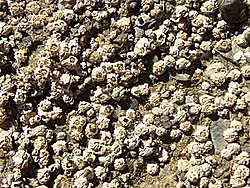
Picture of Balanidae
- Source
- Wikipedia/Commons
- Credit
- DOI (Department of the Interior)
- Licence
- Public Domain
- Commercial use
- the licence allows it
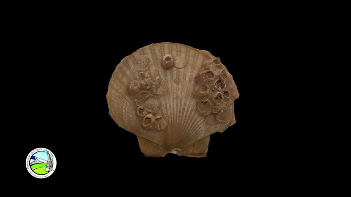
3D model
- Source
- Sketchfab
- Licence
- CC Attribution
- Commercial use
- cannot be read from the licence given — check the record
Smithsonian Open Access and MorphoSource were not reached for this taxon, so this list is what the others held rather than everything there is.
The description on this site
- Source
- Wikipedia, “Balanidae”
- Licence
- CC BY-SA 4.0
This is what the site found, which is not the same as what exists.
Keep going
What may have been alongside itBalanoidea through timeFormations of the MioceneThe world it lived on
Occurrence data from the Paleobiology Database, CC BY 4.0. Leach 1817